All roads lead to... Garstang, apparently
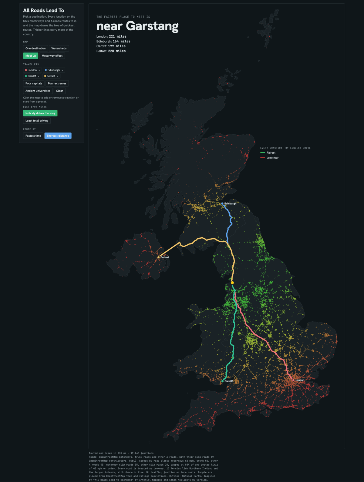
Ethan Mollick made a lovely map called All Roads Lead To building on Arterial Mapping's All Roads Lead to Richmond. I wanted one for the UK, so I made it with my Little Robot Friend. It's live at roads.dougbelshaw.com and the code is on Framagit.
I'm most interested in the view that I show above: where is the fairest place to meet? It turns out somewhere near Garstang, which no-one has ever heard of. People have heard of a little place called MANCHESTER, though, which is nearby.
Yes, this is road-based and, if people are interested I could have a look at expanding it to include trains. The road data comes from OpenStreetMap: every motorway, trunk road and A road, plus slip roads. That's about 99,000 junctions, along with 13 car ferries so Northern Ireland, Shetland, Orkney, and the Isle of Wight. Speeds obviously depend on the type of road and you'll be surprised to learn that it doesn't pull in live traffic data, so the times are on the optimistic side.
Anyway, it all runs in your browser, and is pretty performant.
There's four maps to play with:
- One destination: every route in the UK heading to one place
- Watersheds: cities compete, and each junction drains to the one it reaches fastest
- Meet up: the fairest place for a group to meet (for the four capitals, it's Carlisle)
- Motorway effect: the same map with every motorway closed
The motorway one is interesting. If you close the motorways, Glasgow is more than 3.5 hours further from Birmingham!
If you like this sort of thing, you should follow Tom Watson, who is doing the #30DayMapChallenge on LinkedIn this month. His Day 2 map, "The Ghost Network of the North East", shows the railway lines the region has lost. A rail version of mine would need timetables rather than roads. But that's a job for another day.
Enjoyed this? Get new notes by email
A digest of new notes, daily, weekly or monthly. Confirm by email, unsubscribe any time. Prefer a feed reader? Subscribe via RSS.
Around this note
Shares soil with
Suggested by AI from similar content